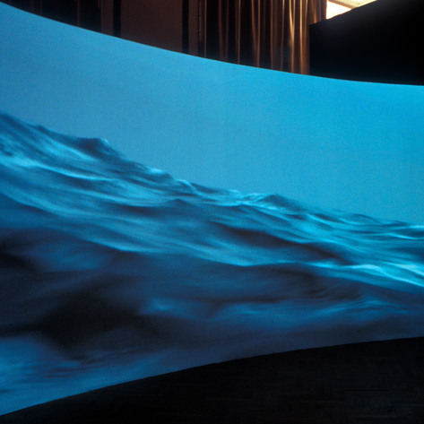
Latitude (v)
Date: 10th April 2005 - Dimensions(m) 2.0, 4.5, 0An immersive reconstruction of William Bligh's open boat navigation of 5800 miles on the Pacific Ocean
Latitude was commissioned by Parabola as part of Dead Reckoning, an exhibition commemorating the 250th anniversary of the birth of Capt William Bligh. Focussing on the notorious mutiny on the HMS Bounty, Cotterrell constructed a simulation of Bligh’s historic 5,800km open boat journey taken in the ship’s lifeboat. Directly informed by the anecdotal and navigational notes taken from Bligh’s log, Cotterrell's panoramic first-person view charts the shifting horizon witnessed by Bligh and his companions on their travels.
The ocean is the ultimate mapping challenge: free from reference points it offers a desert of uncertainty and isolation. The same stars look down on mariners now as 250 years ago but augmented with digital information and analogue communications the electronic maps of the oceans bristle with information. Virtual markers populate the ocean floor with plotted depths, underwater mountain ranges, submerged reefs, tidal currents and volcanic activity. Traversing oceans has, like much of contemporary experience, become mediated through technology and virtual imagery.
Using simulation technology developed by KongsBerg AS, Norway and with advice and support of the Maritime Simulation Unit at South Tyneside College, Cotterrell’s Latitude used data recorded by Bligh in his notebook combined with oceanographic information and a vessel modelled on the original elevation drawings to render with physical accuracy the motion and view of the occupants of Bligh’s launch. Generated in real-time the imagery is not pre-recorded but created mathematically through the coordinates, weather, and other information available. In a sense this is a reverse engineered log-book allowing the audience to translate the notes and figures recorded in Bligh’s journal into sensory experience.
Materials:Projected DVD Video Stream (9 Hours)


